
Monitoring the river ecological network
Protecting the river ecosystem and woodland areas across three provinces, with Spectrum bioacoustic sensors, satellite mapping and educational activities for regional ecological connectivity.
monitored
installed
of project
An ecological corridor broken by urban pressure
River ecological corridors are critical natural infrastructures for biodiversity. They connect isolated habitats, ensure species dispersal and support ecosystem services such as water purification, flood regulation and aquifer recharge. When urbanisation fragments these corridors, impacts propagate system-wide: pollinator populations decline, riparian vegetation degrades and hydrogeological risks increase. Communities along the watercourse depend on the river ecosystem for quality of life and safety.
Mapping biodiversity along the river to understand where to intervene
The Park spans the Lambro corridor, but 35 municipalities fragment its habitats. A pollinator mapping was needed to see where populations thrive and where they decline.
Comparable data over time was needed to track biodiversity trends and a view of ecological connectivity between fragmented habitats.
MiMOBIOVAL: 24 Spectrum and satellite along the river corridor
XNatura designed the monitoring system within the MiMOBIOVAL project, combining satellite analysis, IoT sensors and environmental education.

From satellite to field sensors
A project that integrates remote sensing, bioacoustic IoT sensors and educational activities to build the first complete picture of biodiversity in the Lambro river corridor.
Satellite analysis across 8,403 hectares
Before positioning field sensors, an overview was needed. The satellite mapping of the entire Park, processed with artificial intelligence models, provided a picture of biodiversity potential area by area: vegetation indices, nectar potential, land cover and habitat continuity along the river corridor. The results guided the choice of monitoring stations for field work.
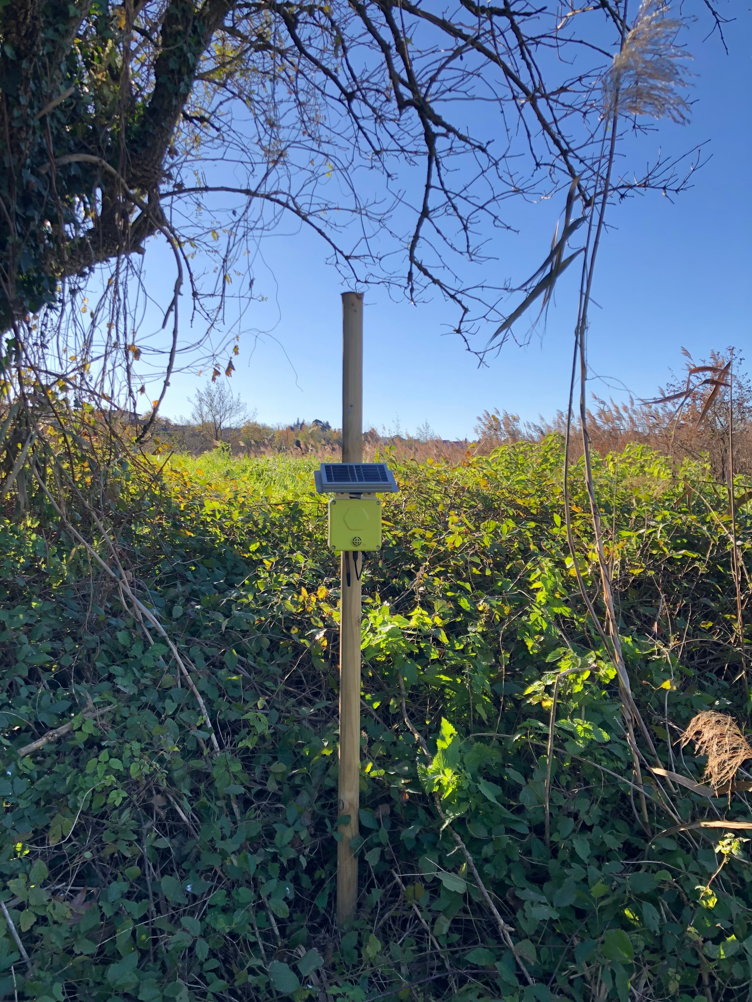
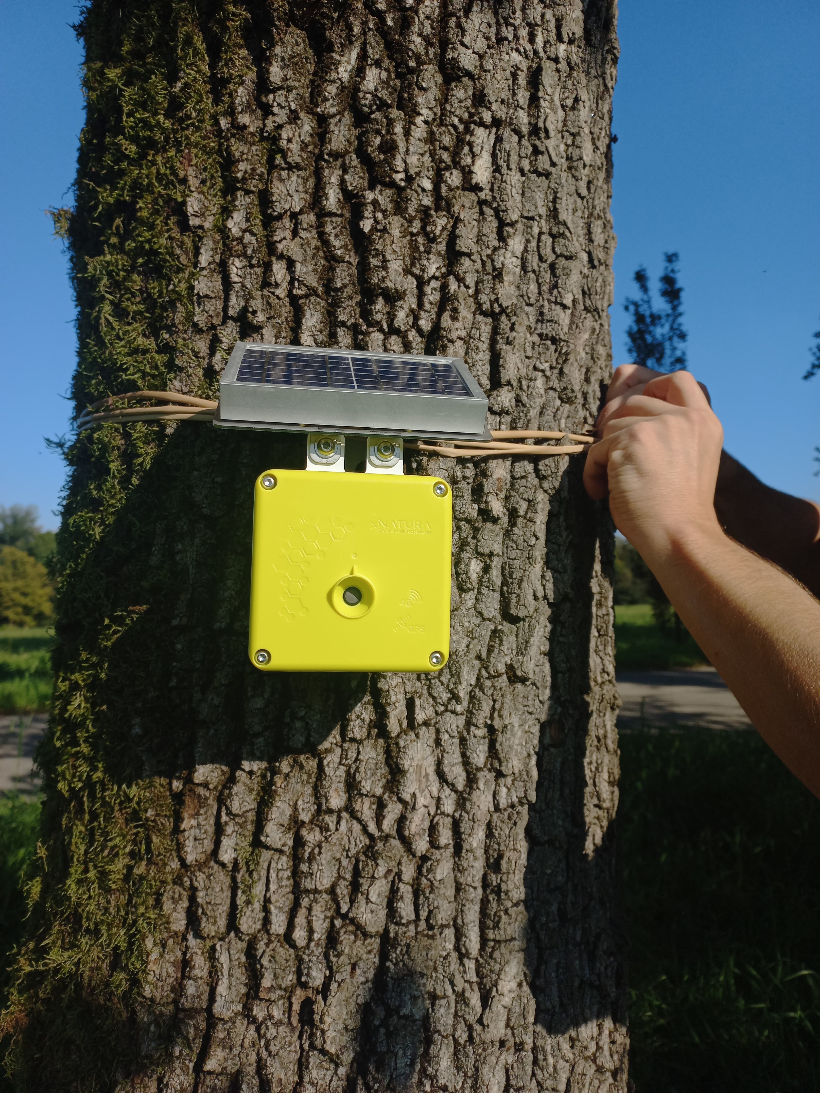
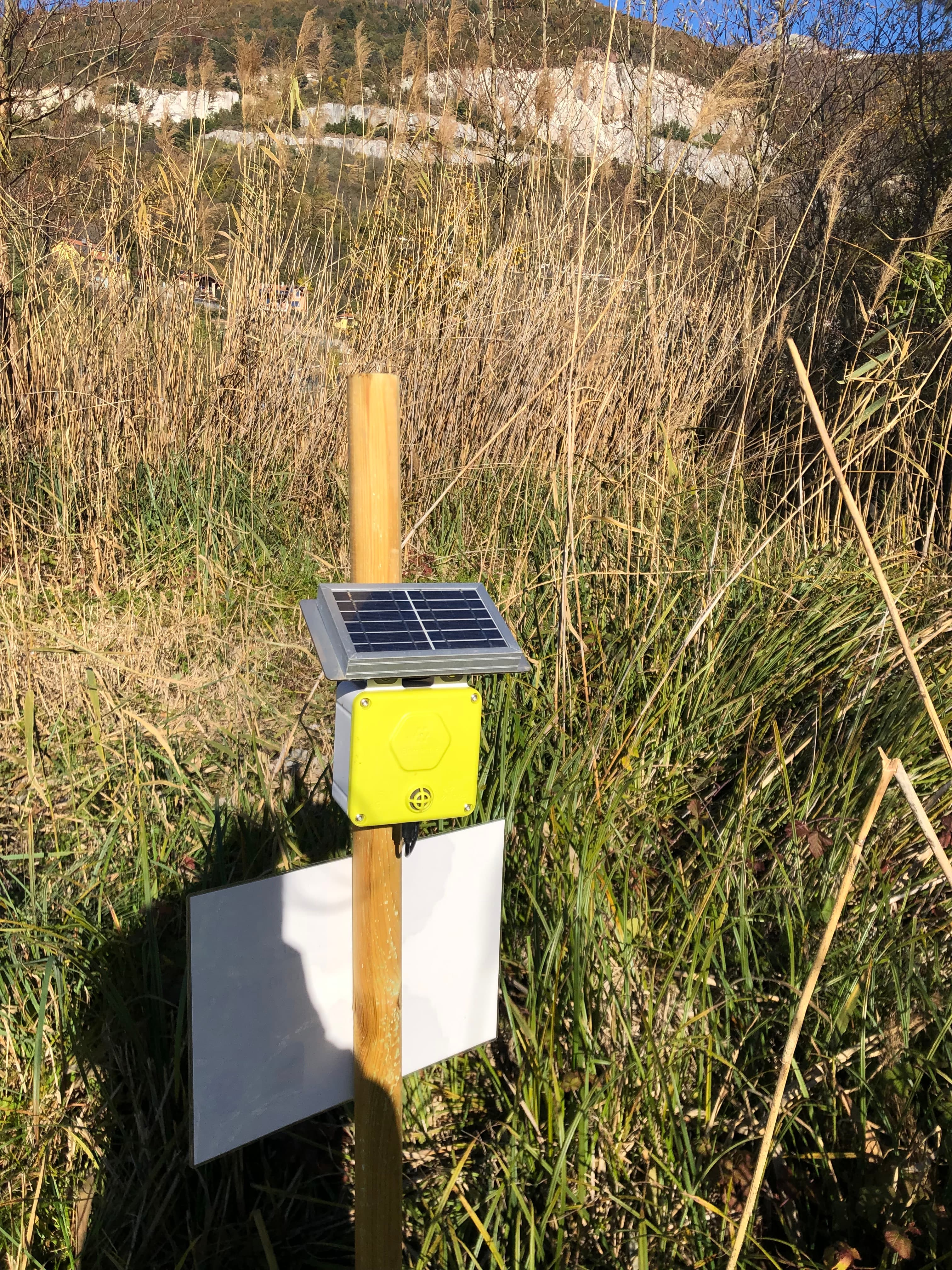
24 Spectrum along the Lambro corridor
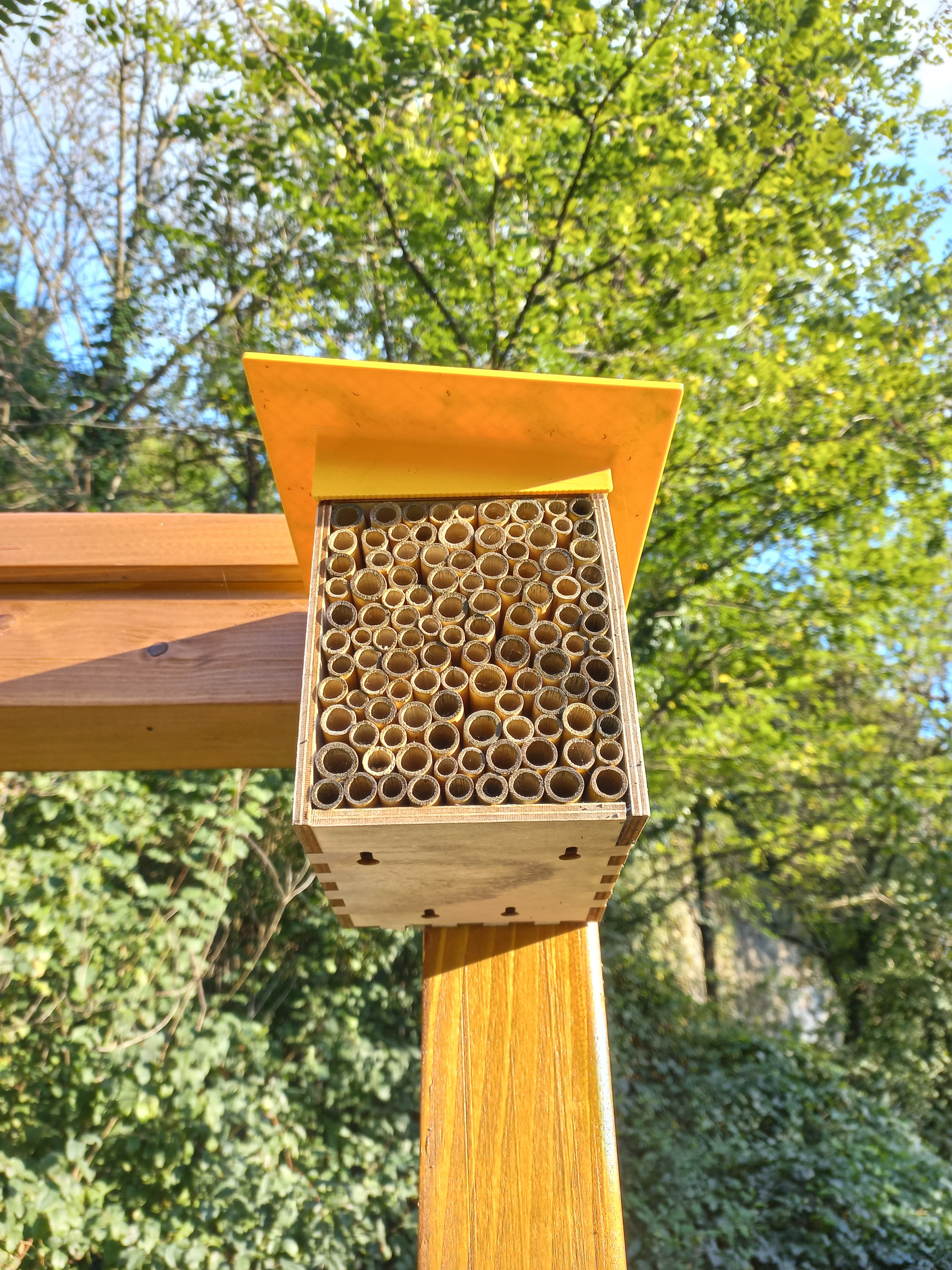
The Spectrum bioacoustic sensors were distributed at stations along the entire course of the Lambro within the Park, selected to represent the variety of habitats: riparian forests, lake areas, stable meadows and urban fringe zones. The Spectrum acts as an electronic ear capable of capturing the sound imprint of pollinators, recording their sounds and classifying them by species, delivering a continuous and non-invasive census.
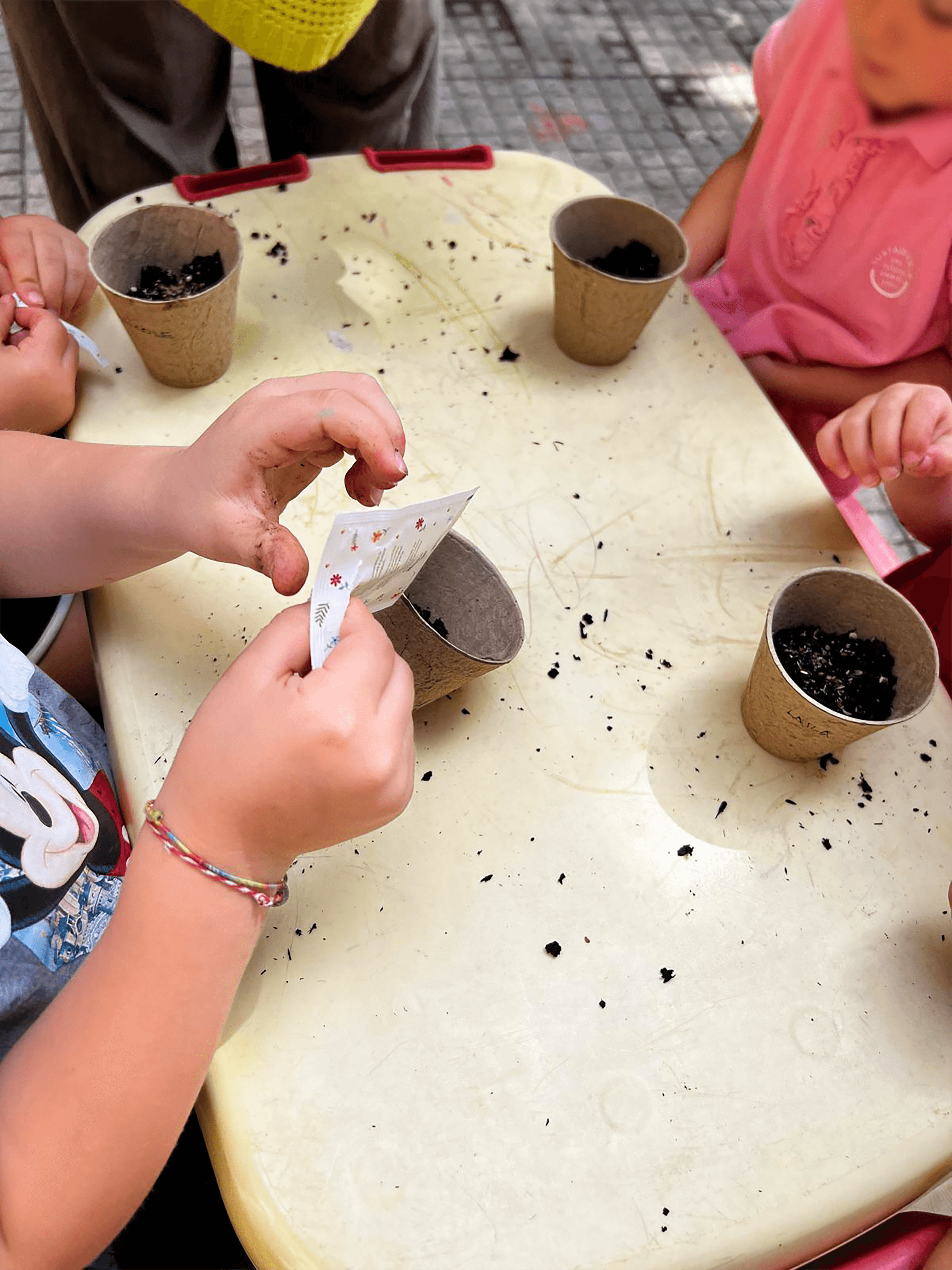
Workshops in schools and in the Park
The Bee Education programme, designed for nursery schools, brought children to explore the Park through sensory workshops dedicated to biodiversity and pollinators. Practical and interactive activities to stimulate the discovery of nature with all the senses, transforming scientific monitoring into an educational experience for the new generations.
From data to ecological connectivity
Data collected from the Spectrum sensors and satellite analysis flow into the XNatura Environmental Platform, providing the Park with a scientific basis for strengthening the ecological connectivity of the river corridor: where to remove alien species, where to reintroduce native species, where to create stepping stones between fragmented habitats. Continuous monitoring enables adaptive management, with priorities that update with the data.
Data from the Valle del Lambro
Site vs Control
analysed on site
monitored
identified
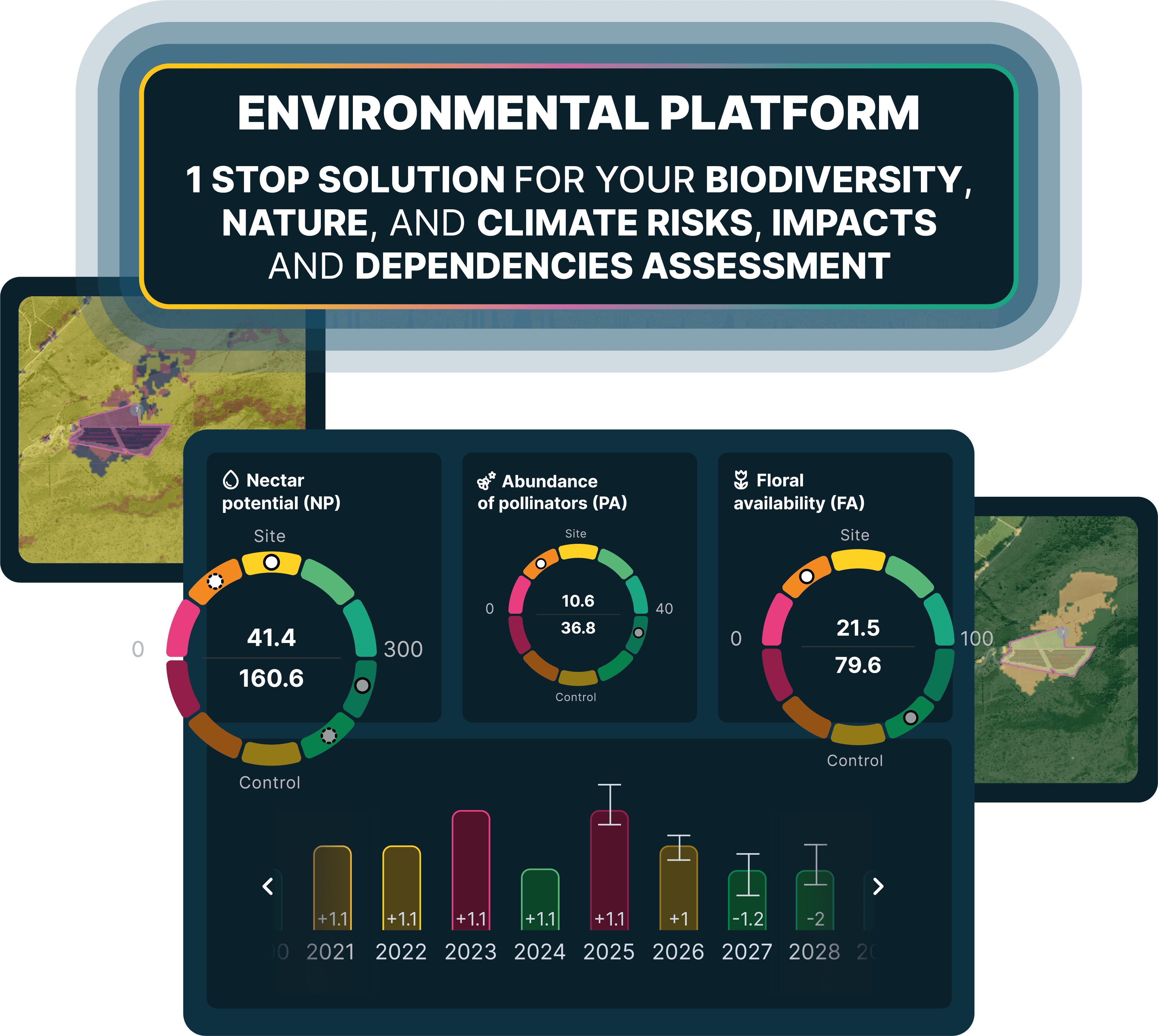
The Spectrum sensors distributed along the river corridor recorded over 18,700 pollinators and identified 19 different clusters across the 6 polygons analysed on site. The data, compared between stations, made it possible to map the areas with the highest density and diversity of pollinators and those most impoverished, providing the Park with a precise picture of species distribution across different habitats.
The site-control comparison revealed an MSA Land Use delta of +33, confirming that areas with greater naturalness along the river corridor maintain significant regenerative capacity. These data directly guide restoration strategies, indicating where to focus interventions to maximise biodiversity returns.
Monitoring in action
Key sections of the XNatura Environmental Platform dedicated to Parco della Valle del Lambro.
Biodiversity status
MSA indices, land cover, Natural Patches, nesting sites, floral availability and nectar potential with comparison between riparian, lake and woodland habitats.
Microclimate
Surface temperature, light pollution and microclimatic parameters along the river corridor, with analysis of anthropic pressure in peri-urban areas.
Drought risk
Aridity indices, vegetation water stress and drought impact on riparian habitats and the Park's wetlands.
Hydrogeological risk
Flood risk, landslide risk and hydrogeological analysis along the course of the Lambro for mitigation intervention planning.
Access the XNatura Environmental Platform
The platform with which Parco della Valle del Lambro monitors biodiversity along the river ecological corridor.
Do you want to monitor the biodiversity of your park?
XNatura supports natural parks, municipalities and protected areas in biodiversity monitoring and conservation, with bioacoustic IoT sensors, satellite mapping and validated scientific protocols, producing data that can be integrated into management and reporting frameworks.

 Contact us for information about the platform or for specialized consulting in the environmental field.