
Environmental Impact Assessment
GIS support, field data, and public sources in a single platform for environmental engineering, natural impact analysis, and risk assessment.
How to Conduct an Environmental Impact Assessment?
The Environmental Impact Assessment (EIA) is the tool used to analyze all possible environmental implications of a project, guiding decisions toward solutions compatible with the territorial context. The main aspects are:
The EIA Process

The Environmental Impact Assessment (EIA) follows a structured process that, step by step, leads to a final decision on the project's environmental suitability.
The purpose of the EIA is to identify, prevent, reduce, compensate, and monitor the negative effects of projects on the environment and human health.Main Phases
The assessment of a project's suitability regarding its environmental impacts typically unfolds through five key stages in most cases.
Main Phases
The assessment of a project's suitability regarding its environmental impacts typically unfolds through five key stages in most cases.
Environmental Impact Study
Gathers all the useful information to evaluate a project. Although the content may vary based on the local regulatory context, there is a core set of common elements established at the European level. XNatura's Environmental Platform supports you in collecting the necessary data during this phase.
SITE CONTEXT


- Protected Areas
- Endangered Species
- Control and Baseline Area
- Aridity
- Climate Variation: current and future

BASELINE AND IMPACTS
The reference climate zone is identified, and the potential presence of protected areas and endangered species in the vicinity of the project area is noted.
Finally, a projection of the environmental scenario without the project is developed to understand the natural evolution of the context in the absence of the project.

The MSA is calculated in relation to the following drivers of biodiversity loss: land use changes, fragmentation, climate change, and disturbance from infrastructure.

The platform also considers cumulative impacts, i.e., those resulting from interactions with other existing or planned projects, and positive impacts, for a comprehensive and balanced view of the project's environmental contribution.


PHYSICAL RISKS

This indicator helps understand how exposed the territory is to aridity conditions, a relevant factor for assessing environmental resilience and site suitability.

The probability of an extreme event in the short term is also provided.

The different portions of the site are then classified based on the degree of deviation from the previously identified less urbanized area.

SITE REGENERATION
Based on these activities, environmental targets are defined, and a targeted action plan is built to achieve them, including specific mitigation and/or compensation measures. These measures aim to make the project more compatible with the environmental context in which it is situated.
Finally, a robust monitoring plan is outlined to verify the effectiveness of the adopted measures and ensure transparency throughout the process.

- PAST
Stakeholders
Policy
- FUTURE
Summary
Stakeholders
Policy and Targets

SITE MONITORING
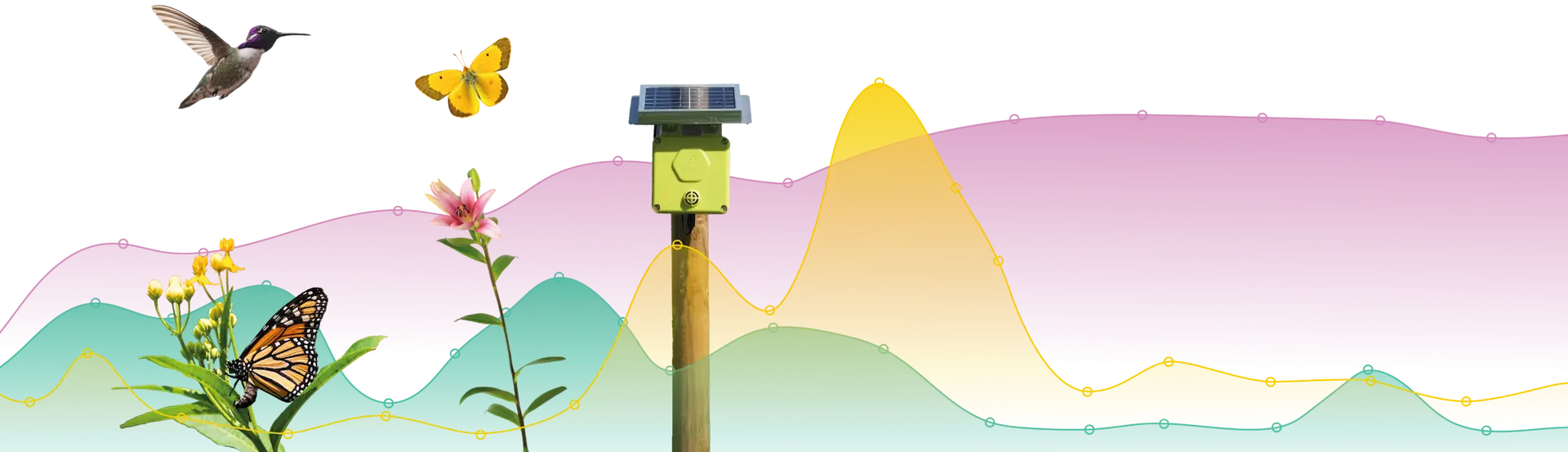
It is carried out periodically through the installation of on-site sensors, direct sampling at the site, and support from our Biodiversa app.
Conclusions and Recommendations
Following the materiality analysis (impacts and dependencies), integration with risk analysis, and disclosure on required topics, it is possible to define a biodiversity transition plan. The analysis leads to the identification of corrective actions aimed at meeting various specific targets belonging to:
Do you want to implement a Strategy or an Action Plan for biodiversity with your company?
How Can XNatura Help You Organize Work in the EIA?
A digital platform can enhance the Environmental Impact Assessment (EIA) process in several ways:
Allows the collection and organization of all environmental data in a single system (e.g., data on emissions, resource consumption, and biodiversity monitoring).
Companies that have chosen XNatura
Choosing XNatura means adopting an innovative, data-driven approach. This ensures transparency and full compliance with environmental regulations.

We are monitoring the impact of our assets on biodiversity, improving it through regeneration efforts such as the creation of our Oases, and increasing our impact by raising awareness among local students.
Read more
With XNatura we are able to assess the impact of our clients, such as mines, on local ecosystems, understanding the levels of biodiversity degradation.

We are proud and happy to lead this important project as Parco delle Groane e della Brughiera Briantea, which once again sees us collaborating with leading Italian universities and organizations that have long been active in our region. Biodiversity is essential for our planet, and its loss is one of the most urgent emergencies we must address today.
Read more
Together with XNatura we are protecting and monitoring biodiversity through the Oases of the Cassa Centrale - Credito Cooperativo Italiano Group, where our goal is to promote projects that protect the natural environment and biodiversity.
Read more
Through our collaboration with XNatura, we have deployed technological solutions to foster respect for nature and the ecosystem, creating sustainable value for future generations.

The issue of biodiversity has always been central to the strategies of Mutti, whose business revolves entirely around a product of the earth, a symbol of Made in Italy in the world: the tomato. Precisely for this reason, within our Green Strategy, we have initiated a program of ecosystem restoration and rehabilitation, which starts from the very land where we have our production facilities. The collaboration with XNatura is therefore essential for us, in order to give scientific validation to our projects and help us in building a long-term strategy that will help us grow and bring increasing value to the environment.
Read more
We are proud to work alongside XNatura's 3Bee project to monitor and regenerate biodiversity in Europe. We started by monitoring honeybees and are expanding the project to regeneration. Through communication on Foxy Love the Bee products and to consumers, we can help spread this awareness and do our part for a more sustainable planet.
Read more
With XNatura, we are monitoring about 1.000 hectares of our supply chain aiming to understand the level of biodiversity and its relationship with our farms.

We decided to give priority to the natural capital of the Group by monitoring 16k ha. We are developing a long-term strategy to enhance the ecosystem services of our assets in collaboration with Generali Country Sustainability & Social Responsibility.
Read more
Respect is one of the core values of Cherry Bank's governance. This world is what we all have in common. Creativity, sensitivity, and innovation are needed to find a balance between new needs and respect for Nature's resources. It’s not the trees that will save the planet, but humankind.
Read more
We are deeply committed to protecting biodiversity and integrating sustainability into our projects. Our initiatives support wildlife, agriculture, and regenerative efforts, to create long-term impacts for a more sustainable future.
Read more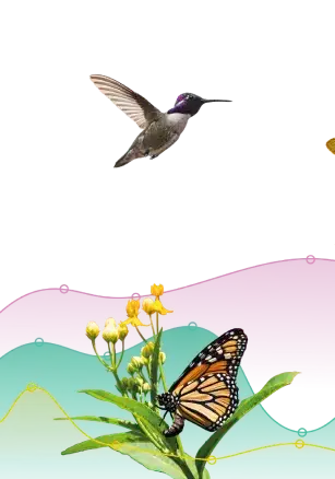

 Contact us for information about the platform or for specialized consulting in the environmental field.