









Vegetation Management System
XN Vegetation — Vegetation Management System
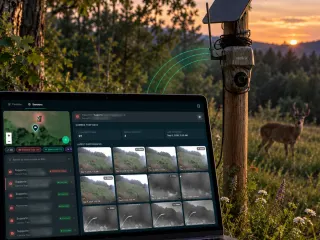
Vegetation health, encroachment and green-area upkeep along your corridors and around your plants, from satellite and field.
For grid, rail and road operators, wind and solar portfolios and large estates that must keep vegetation under control and prove it.

What you receive
- 01
Vegetation baseline
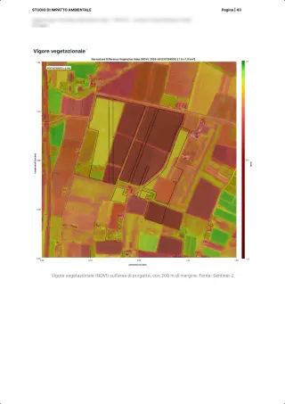
Health, height and encroachment per plot from satellite.Weeks 1–4 - 02
Change detection
Alerts where growth, dieback or clearing changes the risk picture.Per season - 03
Work plan
Cutting, mowing and planting priorities with cost and season.Per season - 04
Compliance record
Evidence of upkeep for regulators, insurers and biodiversity commitments.Every year
What changes when the risk is measured
- 2–6 wks
- from asset list to a ranked nature and climate risk screen
- 6 wks
- to a signed ecological baseline on a priority site
- -70%
- time to a defensible, compliant report versus traditional consulting
- XNatura projects, 2024-2025
- 24h
- reply from a named strategist, for the whole engagement
Data behind the product
Satellite, sensors and field, fused into one living baseline.
Satellite imagery
Vegetation indices per asset and a very-high-resolution image of the site.PER SITECanopy height model
Tree height from a 5 m satellite model.PER SITEIoT and field
Soil and microclimate sensors, drone and ground checks.CONTINUOUSExpert sign-off
An agronomist validates the plan and signs.EVERY DELIVERABLE
Standards covered
One dataset, every framework your auditor asks for.
Grid codes
Vegetation clearance obligations for operatorsESRS E4
Biodiversity in managed green areasBNG
Habitat units on managed land, EnglandISO 14001
Environmental management evidenceEU Nature Restoration
Restoration targets on infrastructure landCSRD
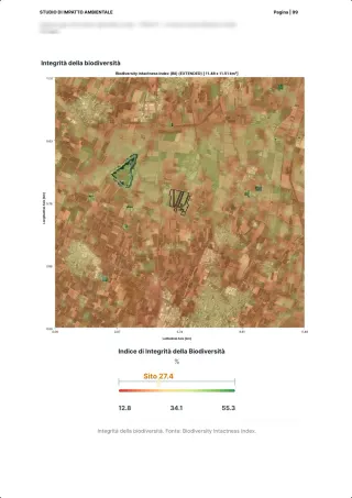
Land-use and biodiversity metrics

XN Vegetation in the field · Infrastructure
Autostrade per l'Italia: vegetation along the motorway monitored from satellite.
Health and encroachment per section, seasonal work priorities for the maintenance contractors, one record for the regulator.
Also on XN Vegetation: wpd · Green Belt Ltd
Read the case study →30 minutes with the team, on XN Vegetation.
Video call on Google Meet
Would you rather talk it through?
Either way you are speaking with an AI assistant, and the conversation is transcribed. How we handle your data
FAQ
Frequently asked questions
What do you receive from XN Vegetation?
Vegetation baseline. Health, height and encroachment per plot from satellite.
What data feeds XN Vegetation?
Satellite imagery: Vegetation indices per asset and a very-high-resolution image of the site.
Which standards does XN Vegetation support?
Grid codes, ESRS E4, BNG, ISO 14001, EU Nature Restoration, CSRD.
Which other XN product is XN Vegetation often combined with?
XN FireSight: Fuel load along the same corridors.