









XN Water Risk · Drought and water stress
Drought and water stress: three measures, three different questions
Water stress means different things: how heavily the basin's water is used, how much the soil is drying with the climate, how much the vegetation is suffering. We keep them apart, each with its own source.

The method
Three measures, each with its source
They are not added up and not converted into one another: they answer different questions.
- Basin
Baseline water stress
Total withdrawals over the basin's renewable supply, from WRI Aqueduct: from Low (under 10%) to Extremely high (over 80%).
- Climate
Drought risk
Soil moisture in CMIP6 models against the 1950-1970 period, with the US Drought Monitor classes; and the SPI-6 precipitation index.
- Vegetation
Vegetation stress
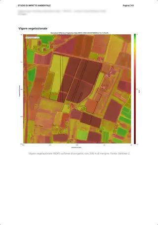
The water content of vegetation from Sentinel-2 (NDMI) and evapotranspiration, month by month.
Sources: Kuzma et al. 2023, Aqueduct 4.0, WRI · Cook et al. 2020, Earth's Future · Gao 1996, NDWI/NDMI, Remote Sensing of Environment · Zaveri, Damania, Engle 2023, World Bank WP 10453
On the platform
What we give for each site
The three measures, plus aridity, each with its class and its source. Drought damage in euros follows the World Bank method of Zaveri, Damania and Engle (2023).
What we give
- The baseline water stress of the basin, with its Aqueduct category
- Drought risk and aridity (P/PET index, UNEP classes) by scenario
- NDMI and evapotranspiration on the site, as monthly series
- The expected economic damage from drought
With their limits
- Baseline water stress is a value per basin: nearby sites share it
- Some class limits are xNatura choices, declared as such
What we do not give
- Groundwater: today we have no data on aquifers
- The site's water use: that is the company's data
- Water quality measured in the field
FAQ
Questions on drought and water stress
What is the difference between water stress and drought?
Baseline water stress says how heavily the basin is used compared with the water available; drought risk says how much the climate is drying the soil compared with the past. A site can be low on one and high on the other.
Which one serves ESRS E3?
The baseline water stress of the basin: it is the indicator ESRS E3 uses as a threshold for areas with water stress.
Do you have groundwater data?
No: today the platform has no data on groundwater.
30 minutes with the team, on XN Water Risk.
Video call on Google Meet
Would you rather talk it through?
Either way you are speaking with an AI assistant, and the conversation is transcribed. How we handle your data