










Resources
Coverage matrix
Before a study starts, see what the platform can give it: for each procedure, the elements the regulation requires and whether our data covers them, covers them in part or not at all.
What we cover, procedure by procedure
For each procedure, the list of elements the regulation requires and which ones the platform covers. Rows whose verdict is «out of scope» are listed like all the others: getting the scope wrong is the surest way to lose the trust of a consultant or a review panel. Every row expands and states why it has that verdict.

Environmental Impact Assessment
The environmental component of the Environmental Impact Study is the part that weighs most in person-hours and the one we cover best. We do not cover the whole EIA: the items below are all the ones that real documents contain, including those we do not provide.
The list comes from real documents — 32 Environmental Impact Studies and annexes from the MASE portal (va.mite.gov.it), surveyed in August 2026. Items are ordered by how many documents actually contain them, not by what suits us best to put first.
 Location of the project areaCoverage: Covered
 List of parks and nature reservesCoverage: Covered
Important Bird Areas (IBA)Coverage: Partial
 Land use mapCoverage: Covered
 Soil map and soil regionsCoverage: Partial
 Vegetation mapCoverage: Partial
 Hydrogeological map and hydrogeological unitsCoverage: Partial
 Geomorphological mapCoverage: Partial
Slope mapCoverage: Covered
Land use / CORINE Land CoverCoverage: Covered
 Erosion / erosion riskCoverage: Covered
Texture / grain sizeCoverage: Partial
 Soil take / soil sealingCoverage: Covered
 Contamination / CSC-CSRCoverage: Partial
 Organic matter / organic carbonCoverage: Partial
 PAI map: flood hazardCoverage: Covered
Metals and pollutants in waterCoverage: Partial
Discharge / hydrometric levelCoverage: Partial
 Nutrients (N, P: nitrates/phosphorus/ammonium)Coverage: Partial
 Turbidity / suspended solidsCoverage: Covered
Map of slope instabilityCoverage: Partial
Geomorphological hazardCoverage: Partial
Flood hazard / flooding (PAI, PGRA)Coverage: Covered
Landslide / geomorphological riskCoverage: Covered
 Fire risk (FWI, classes)Coverage: Partial
 Climate risk analysis (climate proofing)Coverage: Covered
 Photographic documentation of the site visitCoverage: Partial
 Mitigation belts / green screeningCoverage: Partial
 Air quality monitoring stationsCoverage: Partial
 Climatological temperature mapCoverage: Covered
 NO2 / NOxCoverage: Partial
 O3 ozoneCoverage: Partial
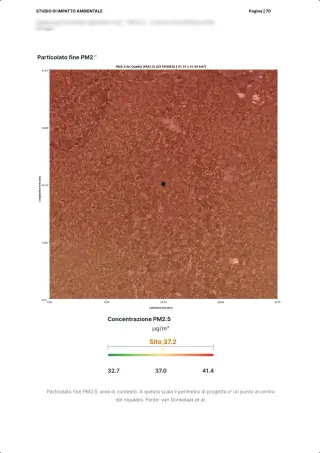
PM2.5Coverage: Covered
 SO2Coverage: Partial
 CO carbon monoxideCoverage: Partial
Air quality monitoring pointsCoverage: Partial
TemperatureCoverage: Covered
 Evapotranspiration / water balanceCoverage: Covered
 Bioclimatic indices (Köppen/Pavari/Thornthwaite)Coverage: Partial
 Value added / GDP / tax revenueCoverage: Partial
 Population / demographicsCoverage: Covered
 Agriculture (UAA, production, GSP)Coverage: Partial
 Fragmentation / ecological connectivityCoverage: Covered
Target species / species of conservation concernCoverage: Covered
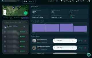 Birds: listening points / IPA / transectsCoverage: Covered
Vegetation cover / phytosociological surveysCoverage: Partial
Abundance / population densityCoverage: Covered
 Establishment of green plantingsCoverage: Partial
 Insect fauna / pollinatorsCoverage: Covered
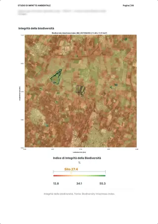
Shannon indexCoverage: Covered
Simpson index / evennessCoverage: Covered
Species richness (no. of species)Coverage: Covered
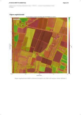
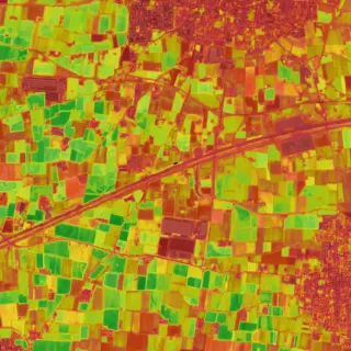
NDVI / remote sensing indicesCoverage: Covered
 dB(A)Coverage: Partial
Leq / LAeqCoverage: Partial
373 elements, each with its own verdict, drawn from 47 real documents on the Italian environmental assessment portal and the platform's 107 catalogue entries. Of these, 349 are environmental and count towards the coverage percentage: the plant's design figures stay listed but out of the denominator.

Appropriate Assessment (Natura 2000)
Annex G names land use mapping as the minimum reference, and it is a layer we produce. The rest of the coverage lies in the characterisation of the site; the judgement on significance remains with the qualified professional.
The list comes from the law — Annex G of DPR 357/1997 and the Appropriate Assessment Study format of the 2019 National Guidelines (sections I-VII), confirmed on 6 real Appropriate Assessment Studies from the MASE portal. Confirmed against 6 Appropriate Assessment Studies (gitignored/mase-vinca), September 2026.
Location and territorial setting with respect to Natura 2000 sitesCoverage: Covered
Map with the boundaries of SACs, SCIs and SPAs overlaid on the worksCoverage: Covered
Use of natural resources and expected physical changesCoverage: Partial
 Waste production, noise and light emissions, accident riskCoverage: Partial
Site Standard Data Form and conservation objectivesCoverage: Partial
Habitat map and land use of the project areaCoverage: Covered
Annex I habitats: presence and area in hectaresCoverage: Partial
Habitats Directive Annex II and IV species presentCoverage: Partial
Birds Directive Annex I speciesCoverage: Covered
Phenology and use of the site: breeding, wintering, passageCoverage: Covered
Abiotic components of the wider areaCoverage: Covered
 Ecological connections of the wider areaCoverage: Covered
Habitat area loss, in hectares and as a percentage of the Data FormCoverage: Partial
Fragmentation and loss of connectivityCoverage: Covered
Qualitative deterioration of habitats and species habitatsCoverage: Covered
Disturbance to species: individuals, pairs, nests affectedCoverage: Partial
Disturbance from noise, lighting and human presenceCoverage: Partial
Attached maps and photographic documentationCoverage: Covered
373 elements, each with its own verdict, drawn from 47 real documents on the Italian environmental assessment portal and the platform's 107 catalogue entries. Of these, 349 are environmental and count towards the coverage percentage: the plant's design figures stay listed but out of the denominator.

Strategic Environmental Assessment
In the plan, biodiversity enters as a context indicator and as a monitoring set. We cover the nature component of the Environmental Report, not the other matrices and not the plan's argumentation.
The list comes from the law — Annex VI of D.Lgs. 152/2006, letters a)-j): these are the information items the law requires to be provided, not suggested chapters. Letter f) is split into the factors it lists itself.
Current state of the environment and its likely evolution without the planCoverage: Covered
Environmental characteristics of the areas likely to be significantly affectedCoverage: Covered
Areas of particular importance: SPAs, SCIs, quality agricultural productionCoverage: Covered
Environmental protection objectives relevant to the planCoverage: Partial
Significant impacts: biodiversity, flora and faunaCoverage: Covered
Significant impacts: soilCoverage: Covered
 Significant impacts: waterCoverage: Partial
Significant impacts: airCoverage: Partial
Significant impacts: climatic factorsCoverage: Covered
Significant impacts: population and human healthCoverage: Partial
Measures to prevent, reduce and offset negative impactsCoverage: Partial
373 elements, each with its own verdict, drawn from 47 real documents on the Italian environmental assessment portal and the platform's 107 catalogue entries. Of these, 349 are environmental and count towards the coverage percentage: the plant's design figures stay listed but out of the denominator.

Environmental Monitoring Plan
It is the multi-year document that follows up on the conditions: same points, same metric, for years. This is where automatic generation matters most, because the report has to be redone after every campaign.
The list comes from real documents — 15 post operam monitoring documents from the MASE portal, plus the layout that recurs in real plans. The August survey had 8, two of which were two-page approval letters: it was redone in September on a larger corpus.
Location of the project areaCoverage: Covered
List of parks and nature reservesCoverage: Covered
Important Bird Areas (IBA)Coverage: Partial
Land use mapCoverage: Covered
Soil map and soil regionsCoverage: Partial
Vegetation mapCoverage: Partial
Hydrogeological map and hydrogeological unitsCoverage: Partial
Geomorphological mapCoverage: Partial
Slope mapCoverage: Covered
Contamination / CSC-CSRCoverage: Partial
Texture / grain sizeCoverage: Partial
Erosion / erosion riskCoverage: Covered
Organic matter / organic carbonCoverage: Partial
Land use / CORINE Land CoverCoverage: Covered
Soil take / soil sealingCoverage: Covered
PAI map: flood hazardCoverage: Covered
Metals and pollutants in waterCoverage: Partial
Nutrients (N, P: nitrates/phosphorus/ammonium)Coverage: Partial
Turbidity / suspended solidsCoverage: Covered
Discharge / hydrometric levelCoverage: Partial
Map of slope instabilityCoverage: Partial
Geomorphological hazardCoverage: Partial
Flood hazard / flooding (PAI, PGRA)Coverage: Covered
Climate risk analysis (climate proofing)Coverage: Covered
Landslide / geomorphological riskCoverage: Covered
Photographic documentation of the site visitCoverage: Partial
Mitigation belts / green screeningCoverage: Partial
Air quality monitoring stationsCoverage: Partial
Climatological temperature mapCoverage: Covered
NO2 / NOxCoverage: Partial
O3 ozoneCoverage: Partial
PM2.5Coverage: Covered
SO2Coverage: Partial
CO carbon monoxideCoverage: Partial
Air quality monitoring pointsCoverage: Partial
Continuous construction-phase monitoringCoverage: Covered
Birds: listening points / IPA / transectsCoverage: Covered
Fragmentation / ecological connectivityCoverage: Covered
Target species / species of conservation concernCoverage: Covered
Abundance / population densityCoverage: Covered
Insect fauna / pollinatorsCoverage: Covered
Vegetation cover / phytosociological surveysCoverage: Partial
Shannon indexCoverage: Covered
Species richness (no. of species)Coverage: Covered
Establishment of green plantingsCoverage: Partial
Simpson index / evennessCoverage: Covered
NDVI / remote sensing indicesCoverage: Covered
TemperatureCoverage: Covered
Evapotranspiration / water balanceCoverage: Covered
Value added / GDP / tax revenueCoverage: Partial
Agriculture (UAA, production, GSP)Coverage: Partial
Population / demographicsCoverage: Covered
Leq / LAeqCoverage: Partial
dB(A)Coverage: Partial
373 elements, each with its own verdict, drawn from 47 real documents on the Italian environmental assessment portal and the platform's 107 catalogue entries. Of these, 349 are environmental and count towards the coverage percentage: the plant's design figures stay listed but out of the denominator.

Building certification: Land Use & Ecology section
The ecology section asks for a baseline, a measure of the change in ecological value and a five-year management plan. Continuous data covers the measurement; the qualified ecologist remains a separate formal requirement.
The list comes from the standard — The items are the fields of our BREEAM GN40 template, the one that already generates the document in production. It is not our own reading of the standard: it is the list the generator actually requires to complete issues LE 02 – LE 05.
Site boundary, extent and settingCoverage: Covered
Baseline ecological survey: habitat inventoryCoverage: Covered
Habitat condition according to the statutory metricCoverage: Partial
Notable and protected species recordedCoverage: Covered
Master species annex in the standard's formatCoverage: Covered
 Key ecological features: mature trees, hedgerows, water bodiesCoverage: Partial
Direct habitat loss quantified by typeCoverage: Covered
Impacts on fragmentation and connectivityCoverage: Covered
Disturbance to wildlife during construction and operationCoverage: Partial
Change in ecological value before and after the interventionCoverage: Covered
Biodiversity unit calculation (statutory metric)Coverage: Partial
373 elements, each with its own verdict, drawn from 47 real documents on the Italian environmental assessment portal and the platform's 107 catalogue entries. Of these, 349 are environmental and count towards the coverage percentage: the plant's design figures stay listed but out of the denominator.

Natural Capital Account
The natural capital account tabulates the ecosystems of a property, their condition and the services they produce, at the opening and closing dates of the period. We cover the physical part of the account (extent, condition, carbon, water, air, species) with measured, repeatable data on the same polygon. The conversion to currency and the property's balance sheet items remain with the client and their verifier.
The list comes from the standard — The list comes from the account template completed for a forest estate managed by an investment fund in New Zealand: these are the items the template asks for, not chapters chosen by us. Confirmed against a natural capital account in progress on a forest estate in New Zealand.
Property boundary and accounting area in hectaresCoverage: Covered
Ecosystem extent by type, reconciled with the IUCN Global Ecosystem TypologyCoverage: Partial
Change in extent and condition between opening and closing of the periodCoverage: Covered
Ecosystem condition relative to a reference conditionCoverage: Partial
Soil organic carbon stockCoverage: Partial
Carbon stock in tree biomassCoverage: Partial
Hydrographic network, water bodies and wetlands of the propertyCoverage: Covered
Surface water qualityCoverage: Partial
Runoff regulation and soil retentionCoverage: Covered
Air quality on the propertyCoverage: Partial
Microclimate regulation: surface temperature and evapotranspirationCoverage: Covered
Exposure to physical and climate risks across the three SSP scenariosCoverage: Covered
Protected areas and ecological connectivity around the propertyCoverage: Covered
Population served and access to green spaceCoverage: Partial
Socio-economic context of the reference areaCoverage: Partial
373 elements, each with its own verdict, drawn from 47 real documents on the Italian environmental assessment portal and the platform's 107 catalogue entries. Of these, 349 are environmental and count towards the coverage percentage: the plant's design figures stay listed but out of the denominator.
FAQ
Questions on the matrix
What does the coverage matrix show?
For each procedure (EIA, Appropriate Assessment, SEA, monitoring plans, BREEAM and others), the elements the regulation requires and whether the platform's data covers them, covers them in part or does not.
How is the coverage percentage calculated?
Covered items count 1 and partial items 0.5, over the environmental items only. The plant's own figures (installed capacity, module count, service life) stay out of the denominator: they belong to the client's project.
Does a covered row mean the study is done?
No. The matrix says what our data can give a study. An expert interprets the data and signs the study: one of our team, or the consultant who leads the procedure.