







 MASE projects
 Wildfires worldwide
 Species worldwide
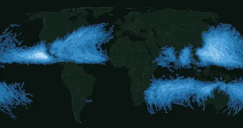 Tropical cyclones
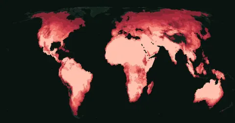 Extreme heat


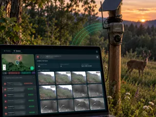
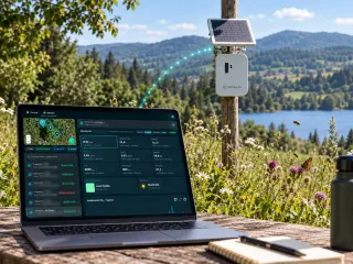

Live data · Solar
Live Data for Solar: vegetation, pollinators and wildlife.
Demonstration site
On a solar or agrivoltaic plant what counts is the meadow under and between the rows, the pollinators on the nectar strips, the birds and mammals that use the fenced area. Below you see how we measure them, with today's data from our demonstration site.
Data as of November 14, 2026 at 6:10 PMOasi 2.0 di Gaminaraprovince of Pavia · 5.4 hectares34 sensors in the field
Birds
since March 2026- speciesHow it is calculatedBird species with at least 20 detections, model confidence of 50% or more, geographically implausible species left out. Without the 20-detection threshold there would be 194, with many false positives.Source: Oasi 2.0 di Gaminara, XNatura platform data as of November 14, 2026
- 106
- detections
- 67,159
Most heard
- Eurasian blackcapSylvia atricapilla11,004detections
- Common blackbirdTurdus merula10,425detections
- European robinErithacus rubecula7,616detections
- Cirl buntingEmberiza cirlus5,201detections
Pollinators
2026 season- buzzes per hourHow it is calculatedPollinator buzzes recognised, divided by the hours the Spectrum sensors listened, over the whole season.Source: Oasi 2.0 di Gaminara, XNatura platform data as of November 14, 2026
- 12.4
- buzzes detected
- 41,830
19 frequency notes detectedHow it is calculatedSpectrum groups buzzes by wingbeat frequency: each frequency is a note. These are the 19 notes heard this season, from 115 to 250 Hz. The more different notes appear, the more groups of pollinators visit the site.Source: Oasi 2.0 di Gaminara, XNatura platform data as of November 14, 2026
In the last 30 days: 1,129 buzzes in 386 hours of listening (2.9 per hour). The chart keeps the whole season, also when activity drops.
Mammals
2026- wild speciesHow it is calculatedWild species with at least 8 passages recognised by the camera traps since the start of the year. Domestic animals and isolated recognitions are not counted.Source: Oasi 2.0 di Gaminara, XNatura platform data as of November 14, 2026
- 6
- passages
- 383
Latest passages
Who passed by
All passages, further downData that serveEIAESRS E4TNFD
Maps
Where it happens.
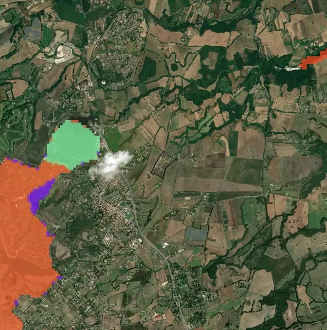
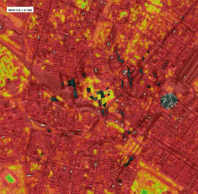
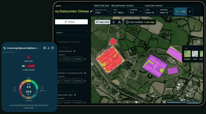
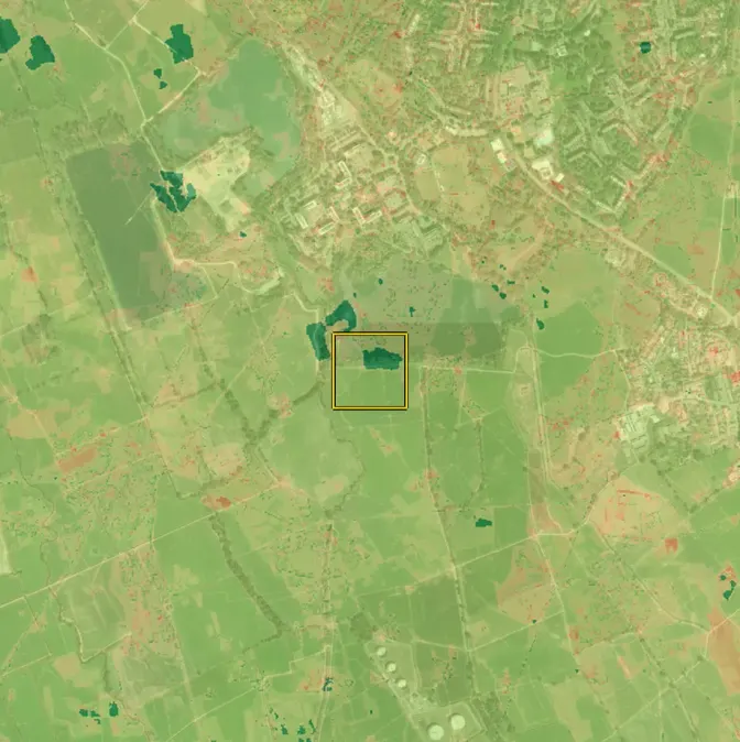
These are the maps of the demonstration site. For a solar plant we produce the same ones: the land before and after the works, the green under the panels, the heat by day and by night.
BirdySpectrumCamera trapsSite boundary
Natural, agricultural, artificial
How much nature lies around the boundary. For a plant it is the starting point: it tells in which setting, agricultural or natural, the project sits.
- Within 2.5 km
- 74.7 % natural
- Agricultural 23.2% · artificial 2.1%
- Inside the site
- 29.7 % natural
- Agricultural 70.3% · artificial 0.0%
Artificial · 55 haAgriculture · 614 haNatural · 1,979 ha
XNatura land use classification, site and surroundings.
Land cover
The land use classes, from arable land to woodland. Compared before and after the plant, they show what has changed.
- Estimated trees on the site
- 182 per hectare
- In the surroundings: 374 per hectare
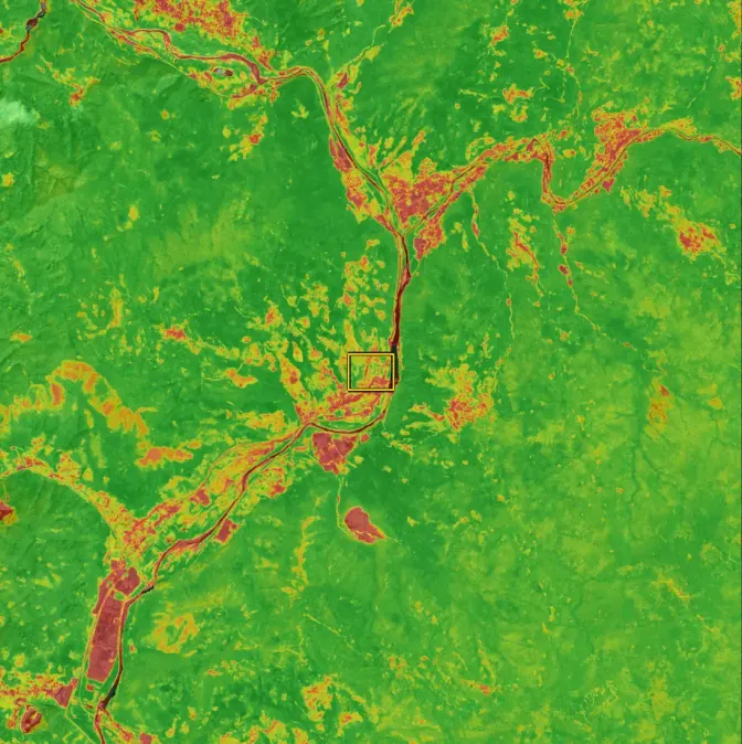
- Greenness (NDVI) of the site
- 0.57
- In the surroundings: 0.51
Forests · 450 haBroad-leaved forest · 442 haQuercus pubescens · 375 haQuercus petraea · 287 haComplex cultivation patterns · 187 haOstrya carpinifolia (1) | Fraxinus ornus (1) · 180 haTriticum aestivum · 157 haRobinia pseudoacacia · 132 ha
The eight largest classes in the surroundings of the site.
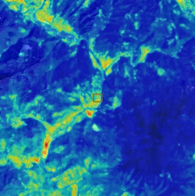
Land surface temperature, by day
Where the ground heats up most in summer. On a plant the temperature between the rows is compared with that of the fields around.
- Mean on the site
- 35.9 °C
- Band B · low
- Mean in the surroundings
- 34.9 °C
- Band A · very low
Image of July 31, 2026 · 8 dates available on the platform.
Land surface temperature, by night
The heat that remains after sunset: at night you see how much of it the ground and the surfaces of the plant hold.
- Mean on the site
- 21.3 °C
- Band B · low
- Mean in the surroundings
- 21.4 °C
- Band B · low
Image of July 21, 2026 · 27 dates available on the platform.
Heat island
How much warmer each point is than the average of the area (UTFVI index): the most direct way to read the thermal effect of a project on its surroundings.
- Mean on the site
- 0.17
- Band A · very low
- Mean in the surroundings
- 0.26
- Band B · low
Image of July 21, 2026 · 27 dates available on the platform.
Greenness
The vigour of the vegetation (NDVI) over time: on a plant it tells how the meadow under and between the rows of panels is growing.
- Mean on the site
- 0.54
- Band B · high
- Mean in the surroundings
- 0.71
- Band B · high
Image of June 30, 2026 · 5 dates available on the platform.
Light at night
Artificial light at night around the site. It is used to check that the lighting of substations and fences stays low.
- Mean on the site
- 1.17 nW/cm²/sr
- Band A · very low
- Mean in the surroundings
- 1.24 nW/cm²/sr
- Band A · very low
Image of January 31, 2026 · 6 dates available on the platform.
Nitrogen dioxide
An indicator of traffic and combustion around the site: useful to describe the setting and the construction phase.
- Mean on the site
- 38.6 µmol/m²
- Mean in the surroundings
- 38.4 µmol/m²
Image of June 30, 2026 · 5 dates available on the platform.
Satellite
The true-colour image, from satellite: the simplest way to see the area before and after the works.
Image of June 30, 2026 · 13 dates available on the platform.
Birdy · bioacoustics
Birds.
Birdy sensors listen to the site and recognise species by their song. Each detection is a five-second clip you can play again. Pick a species to hear it and to see at what time it sings.
Demonstration site
- Sylvia atricapilla11,004detections
- Turdus merula10,425detections
- Erithacus rubecula7,616detections
- Emberiza cirlus5,201detections
- Emberiza calandra2,728detections
- Sturnus vulgaris2,661detections
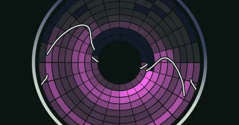
The dawn chorusHow it is calculatedEach cell is an hour of the day in a month: the brighter, the more detections. Hours run around the dial (midnight at the top, the site's local time), months go from the centre to the rim. The two light lines are the real sunrise and sunset, day by day. The dashed cell is now. The count also depends on the hours the sensors listen.Source: Oasi 2.0 di Gaminara, XNatura platform data as of November 14, 2026
Hours around · months from the centre (March) to the rim (November) · all species
fewer songsmore songs
In May, the richest month, half of the songs fall between 7:00 and 12:53.
In numbers
- effective speciesHow it is calculatedThe number of equally frequent species that would give the same diversity: the exponential of the Shannon index the platform computes on the detections.Source: Oasi 2.0 di Gaminara, XNatura platform data as of November 14, 2026
- 27
- Shannon index
- 3.3
- detections per hour
- 8.8
Detections by month
Listen to the latest detectionsLive
The most recent clips arrive live from the site.
Spectrum · pollinators
Pollinators.
Every wingbeat has a frequency. Spectrum measures it and groups it into 19 notes: the more notes appear, the more groups of pollinators visit the site. No cameras, no trapping.
Activity over the season
buzzes per hour of listening · 7-day averageWhen they buzzHow it is calculatedEach cell is an hour of the day in a month: the brighter, the more buzzes. Hours run around the dial (midnight at the top, the site's local time), months go from the centre to the rim. The two light lines are the real sunrise and sunset, day by day. The dashed cell is now. Spectrum sensors listen in daylight hours only.Source: Oasi 2.0 di Gaminara, XNatura platform data as of November 14, 2026
Hours around · months from the centre (March) to the rim (November)
fewer buzzesmore buzzes
In August, the richest month, half of the buzzes fall between 7:00 and 10:52.
The 19 notes
Buzzes by wingbeat frequency
Listen to a note
Camera traps · wildlife
Mammals.
Camera traps film whoever passes, day and night, and a model recognises the species. People are never shown.
The most recent videos arrive live from the site.
The night is theirsHow it is calculatedEach cell is an hour of the day, or a two-hour band when passages are few: the brighter, the more passages of wild species at the camera traps. With few passages the rings are seasons, not months. The two light lines are the real sunrise and sunset; the dashed cell is now. The period starts in March.Source: Oasi 2.0 di Gaminara, XNatura platform data as of November 14, 2026
Hours around · seasons from the centre (spring) to the rim (autumn) · two-hour bands
fewer passagesmore passages
In autumn, the richest season, half of the passages fall between 22:00 and 4:00.
Who passed by
Wild species recognised · passages
- Roe deerCapreolus capreolus141passages
- Wild boarSus scrofa116passages
- Red foxVulpes vulpes61passages
- European badgerMeles meles47passages
- Brown hareLepus europaeus9passages
- Crested porcupineHystrix cristata9passages
Species photos: iNaturalist (Creative Commons licences) and the 3Bee archive.
Technology
Our sensors.
Wireless and connected over 4G. They are mounted on a post or a tree and transmit on their own.
Inside the sensor
Wildy in 3D, from its design files
This model comes from the CAD files the sensor was engineered with. Turn it, get closer and open it to see where the microphone, the boards and the battery sit.
Loading the 3D model...
Drag to turn, scroll or pinch to zoom.
Parts
From the design
- The model follows today's design: shapes and components may still change.
- The enclosure is made of two halves, front shell and back cover, with a gasket between them.
- Inside are the main board, the modem board with its antennas, the microSD card and the battery; on top, the solar panel on a ball joint.
Model: Wildy v0.17 (STEP)
Wildy, our new sensor: Birdy for birds, Kiro for bats, Spectrum for pollinators, in a single box. Its design is in development.
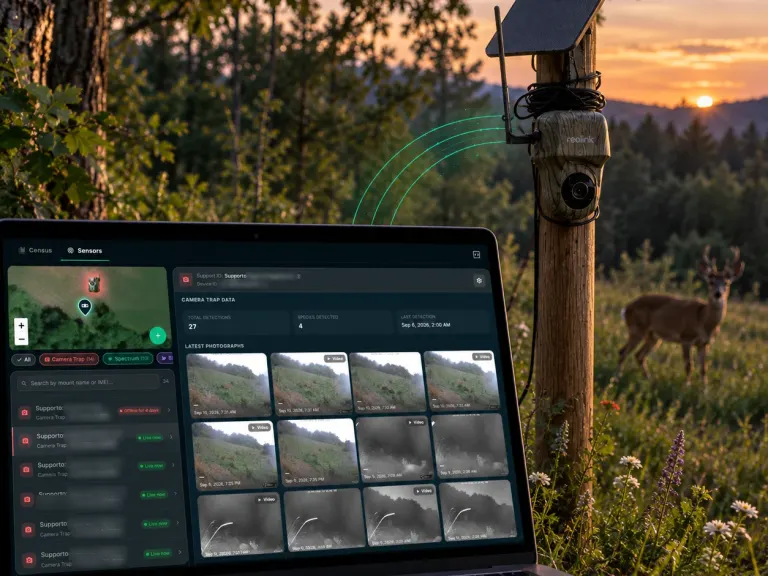
Camera trap
Films the wildlife crossing the site and recognises the species.
Discover the camera trapsPicture these data on your plant.
The problem
Those who permit and those who finance a plant ask what happens to the nature of the site: before, during and after the works. A report written once is not enough: what is needed are measurements repeated at the same points.
The solution
The sensors measure birds, pollinators and mammals all year. The satellite maps follow land, vegetation and temperature. Our ecologists read the data and prepare the monitoring reports.
- 01
A live page
The same page you are looking at, with the data of your plant: to share with authorities, local communities and investors.
- 02
Numbers that hold
Every figure has its clip, its map and its method. It can be heard again and checked again.
- 03
Data before and after the works
The same measurements, repeated at the same points, are useful for monitoring before and after construction and for sustainability reporting.
Want to see it on your plant?
Tell us where the plant is: we prepare the maps of the site and tell you which sensors it needs. The offer comes from our team.
FAQ
Frequently asked questions
How up to date are the live data for solar?
The sensors transmit several times a day. The page reads the latest detections when you open it and shows how long ago the last reading arrived. Numbers and charts are recalculated every night.
Which sensors does a solar plant need?
It depends on the site: usually one Spectrum for pollinators on meadows and nectar strips and one Birdy for birds; camera traps are added for large or fenced areas. We decide together after looking at the maps of the site.
Can the live sensor data be used in the monitoring of a solar plant before and after construction?
They are continuous measurements, with date, time and position, and every detection can be heard again. They can support monitoring before and after construction; what your case requires is set by the conditions of the plant's permit, and we look at it with our ecologists.
How do you read the rings of the year in the live data for solar?
The hours of the day run around the dial, with midnight at the top and noon at the bottom. Each ring is a month, from the centre to the rim. The brighter a cell, the more detections in that month at that hour. The two light lines are sunrise and sunset at the site.
Where do the data on this solar page come from?
From Oasi 2.0 di Gaminara, our demonstration site: an oasis followed by 3Bee with Birdy, Spectrum and camera traps in the field. It is not a solar plant: we show it because it has all three families of sensors. The same instruments and maps are installed on a plant.