










XN FireSight · Italian law
Italy's wildfire framework law: constraints, catasto, AIB plan
Law 353/2000 ties precise constraints to land burnt by fire and gives the catasto and the plans to municipalities and regions. We can bring maps and indices to those who prepare them; we are not the catasto and we never say whether a parcel is constrained.

The law
What law 353/2000 asks
The consolidated text on Normattiva, as amended by Decree-Law 120/2021. The rules below apply to woodland and pasture burnt by fire.
- Art. 10(1)
Constraints
15 years with no change of land use, 10 years with no new building, 5 years with no publicly funded reforestation, 10 years with no grazing or hunting.
- Art. 10(2)
Catasto
Kept by municipalities: land burnt in the last five years, updated every year, posted for 30 days for observations.
- Art. 3
AIB plan
Approved by the region: risk areas on thematic maps, risk periods, danger indices, the wildland-urban interface, satellite monitoring.
- Art. 10(5-6)
Bans
In areas and periods at risk, actions that can start a fire are forbidden: fines from 5,000 to 50,000 euros.
Sources: Law 353/2000 (Normattiva, Italian) · Decree-Law 120/2021, art. 5 (Normattiva, Italian)
What we bring
Maps and indices for those who prepare plans and checks
For the catasto, municipalities may use the technical support of qualified bodies (art. 10(2), since Decree-Law 120/2021). Here is what our data can give, and what it cannot.
From the data
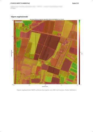
- Thematic maps of the areas at risk: the 30 m index, fuel, the wildland-urban interface
- Weather danger indices (FWI) and their climate projections by scenario
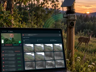
- Satellite monitoring of hotspots around the area
To be agreed
- The interface is read on vegetation, not on the density of buildings
- The delivery format and the region's official indices: to be agreed with whoever drafts the plan
What we do not do
- The catasto of burnt land: the municipality sets it up and approves it
- Say whether a parcel is constrained
- Replace the Civil Protection bulletin or the regional AIB services
The report
The rules, inside the report
The wildfire risk report on the Como site gathers the Italian and European framework in its own pages, next to the site's maps and figures.
Leaf through the wildfire risk reportFAQ
Questions on the rules
Can you update my municipality's catasto?
No. The municipality sets up and approves the catasto; the law lets it use the technical support of qualified bodies. Today we do not have a burnt-area layer with perimeters to verify.
Do companies have duties?
In areas and periods at risk the bans and duties of the regional plan apply to everyone, with fines from 5,000 to 50,000 euros (art. 10(5-6)). Each region has its own plan: read the one of the site's region.
Is there a European rule too?
Not a binding one on wildfires: in March 2026 the Commission published a communication on integrated wildfire risk management (COM(2026) 330). For companies, wildfire is among the climate hazards of the EU Taxonomy.
30 minutes with the team, on XN FireSight.
Video call on Google Meet
Would you rather talk it through?
Either way you are speaking with an AI assistant, and the conversation is transcribed. How we handle your data