










XN Twin · Natural environments
Natural environments: forests and habitats measured in 3D
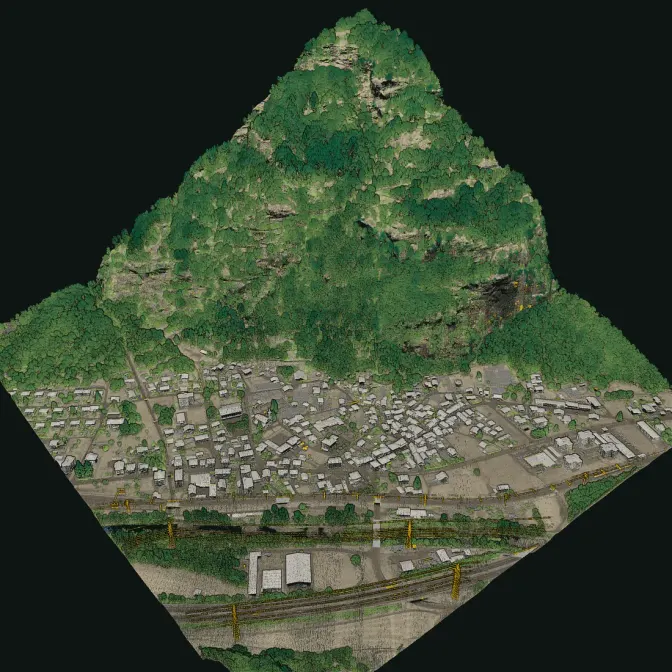
From the drone, part of the laser passes between the leaves and reaches the ground: it measures the terrain under the forest and the height of the trees. On foot, under the canopy, the same scanner sees the trunks, the layers of the forest and the dead wood on the ground. Together they make a 3D model of the habitat.

The rules
The EU asks to measure the structure of forests
Regulation (EU) 2024/1991 on nature restoration, applicable since 18 August 2024, asks member states to improve the biodiversity of forests and to show it with the common forest bird index and with at least six of seven indicators, among them standing and lying deadwood, the share of forests with uneven-aged structure, forest connectivity and tree species diversity. Implementing acts will set how the indicators are monitored.
- 1
The area
A forest, a park, a river bank or a restoration area, with its perimeter.
- 2
The survey
Drone flights over the canopy and walks under it with the handheld scanner.
- 3
The measures
Terrain, tree heights, canopy cover, layers of the forest and deadwood where it shows.
The data
What LiDAR measures in a forest
Shapes and heights, from above and from below, on the same perimeter as the site's habitats and species.
What we deliver
- Terrain model under the canopy, from the drone
- Canopy height model and the gaps in the cover
- Trunks along the walked paths, with their position and diameter measured on the point cloud
- Vertical structure: the layers of the forest and the understorey
- Standing dead trees and lying trunks that show in the point cloud
- The site's habitats, protected areas and satellite layers from the platform, on the same perimeter
Limits
- LiDAR measures structure, not species: species come from field surveys and sensors
- Under a dense understorey part of the lying deadwood stays hidden; its volume is an estimate
Stays with the forester and the ecologist
- The forest management plan and the cuts
- The choice of restoration measures
- The reporting of the Regulation's indicators, which is the member states'
Then
Measured again over the years
The same survey redone on the same area shows what changed: growth, gaps, deadwood after storms or cuts. Species and habitats come from XN Ecology and XN Biodiversity, on the same site.
FAQ
Questions on natural environments
Does LiDAR see the ground under the forest?
Yes, in part: some of the laser pulses pass between the leaves and reach the ground, so the terrain under the canopy can be modelled. Where the cover is very dense, the handheld survey from below fills the gaps.
Does it recognise tree species?
No. LiDAR measures shapes and heights. Species come from field surveys, with XN Ecology, and from the sensors of XN Biodiversity.
Can it measure deadwood for the Nature Restoration Regulation?
It measures the standing dead trees and the lying trunks that show in the point cloud of the surveyed area. The official methods for monitoring the indicators will be set by the EU implementing acts.
Have you already surveyed forests with XN Twin?
XN Twin is new in 2026 and the first surveys are pilot projects: we show no case we have not done.
30 minutes with the team, on XN Twin.
Video call on Google Meet
Would you rather talk it through?
Either way you are speaking with an AI assistant, and the conversation is transcribed. How we handle your data