










XN Twin · Assets for risk
Assets for risk: buildings, plants and land measured in 3D
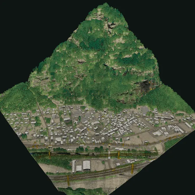
To insure or protect an asset you need to know it: how high the ground floor stands above the road, where the machinery is, how the roof is shaped, which trees are close to the buildings. A LiDAR survey from the drone outside and by hand inside measures all of it, with centimetre detail.

The rules
In Italy, company assets must be insured against catastrophes
Law 213/2023 (art. 1, paragraphs 101-111) obliges companies registered in Italy, and foreign companies with a permanent establishment there, to insure their land and buildings, plants and machinery, and industrial and commercial equipment against earthquakes, floods, landslides, inundations and overflows. The deadlines were staggered by company size during 2025. Failing the obligation is taken into account when public grants, subsidies and incentives are awarded.
- 1
The assets
You tell us the site and what to survey: buildings, sheds, plants, yards and land.
- 2
The survey
The drone over roofs and ground, the scanner by hand inside buildings and plant rooms, in one coordinate system.
- 3
The measures
Elevations of floors and openings, footprints and volumes, trees close to the buildings, in a report and in open formats.
The data
What the survey gives you
Measures taken from the point cloud, for the insurer, the appraiser and the climate risk analysis.
What we deliver
- Georeferenced point cloud of buildings and land, from the drone and by hand inside
- Terrain and surface models of the whole site
- Elevation of ground floors, doors and openings above the terrain, the figure that counts against floods
- Footprints, heights and volumes of buildings and sheds
- Position of plants and machinery inside the buildings surveyed by hand
- Trees and vegetation close to buildings and plants
Limits
- The survey measures geometry: it does not give the value of the assets or their structural condition
- Inside, the handheld survey needs access to the rooms and a safe path
Stays with you and your advisors
- The value of the assets and the sums insured
- The policy, chosen with the insurer or the broker
- Structural and seismic assessments, signed by an engineer
Then
From the survey to climate risks
The same site can be analysed with XN Clima: floods, earthquakes, wind and heat, with the economic damage in euro.
FAQ
Questions on assets for risk
Does the survey replace the appraisal of the assets?
No. It measures geometry: heights, areas, volumes, positions. The value of the assets and the sums insured are set by the appraiser and the insurer, who can work on measured data instead of drawings.
Can you survey inside plants and warehouses?
Yes, with the scanner off the drone, carried by hand: rooms, warehouses, plant rooms and basements, wherever there is access and a safe path.
What formats do we receive?
The point cloud in LAS/LAZ and E57, which GIS, CAD and BIM software read, the terrain and surface models and a report with the measures.
Have you already surveyed assets like these?
XN Twin is new in 2026 and the first surveys are pilot projects: we show no case we have not done.
30 minutes with the team, on XN Twin.
Video call on Google Meet
Would you rather talk it through?
Either way you are speaking with an AI assistant, and the conversation is transcribed. How we handle your data