










XN Impact · Appropriate assessment
Appropriate assessment: the site's data, before and after the decision
For a project near a Natura 2000 site we bring the maps, habitats, birds and monitoring the appropriate assessment needs and, after the decision, the technical answer to its conditions. The judgement on significance stays with the professional who signs the study.

The rule
Three stages, set by Article 6 of the Habitats Directive
Article 6 of Directive 92/43/EEC requires an appropriate assessment of any plan or project likely to have a significant effect on a Natura 2000 site, alone or in combination with others. Each Member State transposes it; in Italy, where our cases are, Article 5 of Presidential Decree 357/1997 does, and for projects subject to EIA the appropriate assessment is part of the EIA procedure.
- Stage I
Screening
Whether the project may have significant effects on the site. If they can be ruled out, the procedure ends here.
- Stage II
Appropriate assessment
The study describes project and site, assesses the effects on the conservation objectives and sets out the mitigation measures.
- Stage III
Derogation
If the effect remains adverse, the project can go ahead only without alternatives, for imperative reasons of overriding public interest and with compensatory measures.
Sources: Directive 92/43/EEC, Article 6 · Presidential Decree 357/1997, Article 5 (Italian) · Italian national guidelines, 2019 (MASE, Italian)
The platform's data
Of the 27 items of the study, our data covers 11, and 9 more in part
We compared the format of the study in the Italian guidelines with six real studies from the environmental assessment portal of the Italian Ministry of the Environment (MASE), item by item.
Covered
- Location of the site and its distance from Natura 2000 sites, with the SACs, SCIs and SPAs mapped over the project
- Habitat and land use map, the minimum reference Annex G names
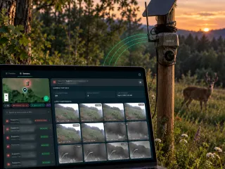
- Birds of Annex I of the Birds Directive and their phenology, recorded continuously by Birdy sensors
- Abiotic components and ecological connections of the wider area
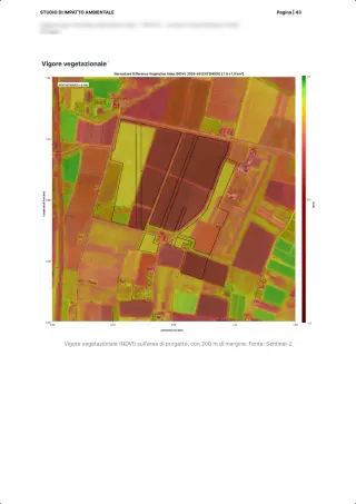
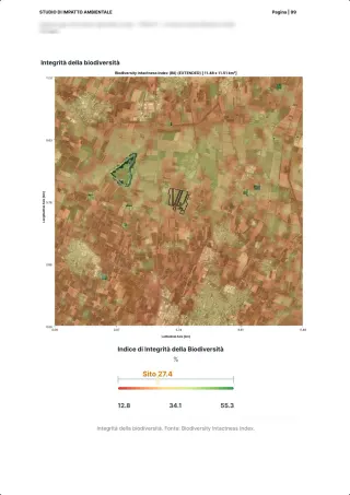
- Fragmentation and deterioration of habitats, measured with MSA and NDVI
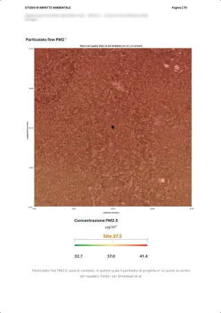
- Map annexes and post-construction monitoring on the same indicators
In part
- Annex I habitats: we give ecosystems and areas, assigning them to habitat codes stays with the expert
- Annex II and IV species: the species observed, with their IUCN status; matching them to the annexes for the site is done by hand
- Bats: night activity yes, species and flight paths no
- Habitat area lost: we calculate it; comparing it with the site's Standard Data Form needs that document
- Noise, light and human presence: as context layers, not as a forecast of the project's disturbance
Stays with whoever signs the study
- Technical description of the project and its schedule
- Cumulative effects with other plans and projects
- The assessment of significance and the study's conclusions
- Alternatives and compensation, in stage III
After the decision
The technical answer to the conditions
When the appropriate assessment ends with conditions, our team writes the technical answer and follows it in the field. In the example report, for a solar plant: a perimeter hedge of 1,830 plants of the 11 prescribed native species, three years of aftercare, three years of insect monitoring with Spectrum acoustic sensors and butterfly transects, no synthetic chemicals, rodenticides only with contained trapping.
Example reports
See what you receive: real reports, anonymised
Deliverables our experts signed for real clients, with names, places and coordinates removed. Pick one, leave your details and download the PDF straight away.
Your report is ready.
Open it now; a strategist may follow up if it fits a project of yours.
Download the PDF ↓Our systems are temporarily unreachable and the request did not go through. Try again, or write to info@3bee.com.
FAQ
Questions on the appropriate assessment
Do you write the appropriate assessment study?
No. We bring the data and maps the study needs and, after the decision, the technical answer to the conditions. The study and the judgement on significance are signed by the professional the developer appoints.
Does a project outside a Natura 2000 site need one?
It can: the directive looks at significant effects on the site, not at where the project stands, so a project outside the site that may affect it counts too. Screening is how you find out, and the distance from the Natura 2000 sites is the first figure we give you.
How does it relate to the EIA?
In Italy, for projects subject to EIA the appropriate assessment is part of the EIA procedure (Presidential Decree 357/1997, Article 5(4)). That is why the EIA page and this one work on the same data.
30 minutes with the team, on XN Impact.
Video call on Google Meet
Would you rather talk it through?
Either way you are speaking with an AI assistant, and the conversation is transcribed. How we handle your data